
EO Detective ID YO24-3011-JRM-256MU
 What do you work on?
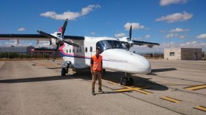
I mainly work with computer models, using them to understand emissions of greenhouse gases. We can see if the models are doing a good job by comparing them with satellite measurements, this helps us improve the models and better understand the climate system of the whole Earth. Of course, we also have to check the measurements the satellites make and we do this using instruments that are closer to home. This is why I was in Albacete, Spain recently: we used the plane to take pictures of farmland to compare with satellite data.
How did you come to be an EO Detective?
Earth Observation Science always appealed because it has a big impact, and satellites make interesting pictures.
I studied Physics, Maths, Further Maths and Computing at A-level, then Physics with Astrophysics for my degree. I taught in secondary schools for three years, but then got the chance to do a masters degree in Oceanography. Now I’m finishing my PhD in Atmospheric Chemistry using satellites.
 What do the images show?
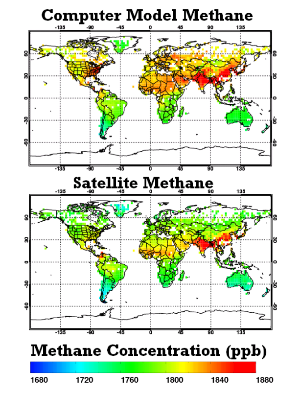
The maps compare levels of methane (the second most important greenhouse gas) calculated using a model with data collected from satellites. The charts are another way of showing how well different models agree with the satellite data. This is important because it helps us to see where the greenhouse gases are being emitted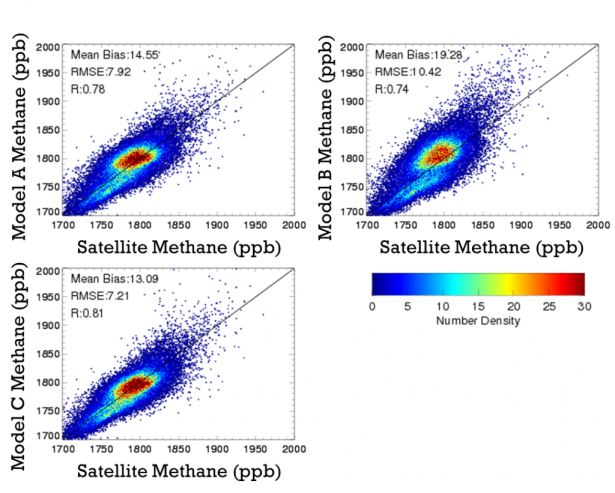 now, and we can find out the best model to use to predict where they will come from and what they will be like in the future. This helps us understand climate change better.
How is the data you use collected?
I use all sorts of observation data, some is very local and some is global. We get information about greenhouse gas concentrations at the surface from a network of sites run by the National Oceanic and Atmospheric Administration (NOAA). Devices called flux chambers measure the emission of greenhouse gases at a particular place and we also use instruments called spectrometers which measure up into the atmosphere. These same instruments are on board satellites, such as the Japanese Greenhouse gases Observing SATellite (GOSAT), which use them to measure greenhouse gases in the atmosphere across the world.
What’s the best thing about your job?
I enjoy producing pretty pictures and knowing that they can be used to better understand how greenhouse gases influence the climate.
Tell us about your favourite image of the Earth from space
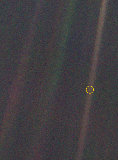
This famous image is known as The Pale Blue Dot and was taken from the edge of the solar system in 1990 by the Voyager 1 space probe. In it, Earth takes up less than a pixel (that’s why I’ve put a circle round it). The photo is interesting because it shows just how small the Earth is compared to all the universe around it. The fact that within that dot is every single person on planet Earth is just amazing!
What do you do in your spare time?
Playing football, watching football, playing FIFA, playing fantasy football and … football.
